Grid/Map Projection
Grid/map projections are supported in several ways including the following:
-
The Enter Grid Values feature within the Coord. Options pull-down list on the Master Coordinate dialog allows you to enter base station coordinates in any defined grid, including ECEF.
-
You can output final coordinates in a map projection of your choice. See Preferences and Show Map Window for additional information.
-
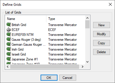
Several grids, like UTM, TM, and US State Plane, have been pre-defined in the software. However, you can also add your own by selecting New within the Define Grids dialog as shown on the right.
-
Use the Transform Coordinates tool under Tools | Grid/Map Projection to convert between geographic coordinates and grid coordinates.
Transform Coordinates
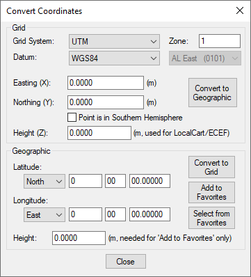
This tool transforms coordinates for a single point from geographic to grid, or vice versa.
|
|
Use the Add to favourites button to save a converted coordinate for easy retrieval in future projects. |