Compute Geoid Height
Geoid files are required when exporting Mean Sea Level (MSL) heights. Geoid files contain a grid of undulation values that represent the difference between ellipsoidal and MSL height. To calculate MSL height from ellipsoidal height at any geographic position, an interpolated geoid height (undulation value) is subtracted from the ellipsoidal height. A Lagrange interpolation method is used.
Waypoint software supports a proprietary WPG geoid format. All publicly available WPG files can be found here: www.novatel.com/support/waypoint-support/waypoint-geoids/. Waypoint software also provides utilities to create WPG files from ASCII files and other known formats in order to create custom or local geoids.
Every project requires ellipsoidal base station heights. This is because the geoid is a complicated mathematical surface and all data processing needs to be performed relative to the ellipsoid. However, the Enter MSL Height feature on the Master Coordinate dialog permits you to work directly with published MSL heights. This works by back-calculating an ellipsoidal height provided an MSL height and a geoid file.
Regardless of how you have entered your base station coordinates (i.e. if you have directly entered an ellipsoidal height or if you have used the Enter MSL height feature), the Export Wizard will prompt you for a geoid if your export profile contains MSL heights.
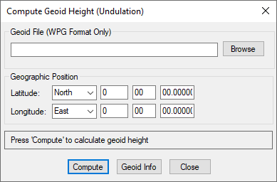
The Compute Geoid Height dialog allows you to calculate geoid height for individual coordinates. If you have a list of coordinates to convert from ellipsoidal to MSL (or vise versa), use the Convert Coordinate File feature. The Geoid Info button will access basic properties of the WPG file, including the datum, vertical datums and geographic boundaries.