Convert Coordinate File
This tool takes an ASCII file containing a list of coordinates as an input and outputs an ASCII file to a different datum or format. You can use this utility not only to convert between datums, but also to change the format of a file. For example, you can convert an input list of coordinates from geographic to ECEF, or a list of coordinates with ellipsoidal heights or MSL.
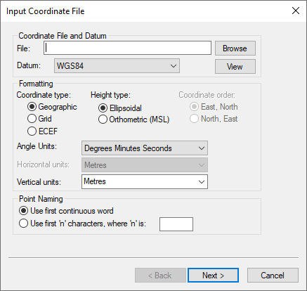
The Use first continuous word option is the default. If the station names contain spaces, select Use first ‘n’ characters. The sign conventions used for geographic coordinates is positive for the northern and eastern hemispheres and negative for the southern and western hemispheres.
Additional options seen on the screen just before generating the output file include the following:
Include column header
Conserves the header information from the input file.
View output files after conversion
Automatically opens the output file after clicking Finish.
Input grid coordinates in southern hemisphere
Only necessary if the input data has grid coordinates from a project area that is in the southern hemisphere.
Do not apply datum transformation to height
This option is useful for outputting orthometric heights because no datum transformation are applied in this case.
Output map scale factor and convergence
This options allows for the output of the map scale factor and convergence when outputting in a grid format.