Satellite View
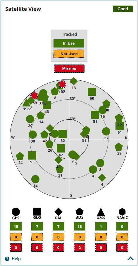
The Satellite View tile displays each satellite the receiver is tracking in graphical format. Concentric circles from 0° to 90° represent elevations from the horizon to directly overhead.
The satellites being tracked are represented with icons according to their satellite system. The PRN of the satellite tracked appears below the Satellite icon.
-
If the Satellite icon is green, the satellite is used in the positioning solution.
-
If the Satellite icon is amber, the satellite is being tracked but is not used in the positioning solution.
-
If the Satellite icon is red, the satellite is missing.
A legend on the Satellite View tile identifies the icon used for each GNSS constellation and the number of satellites used in the solution, the number tracked but not used and the number missing.
The Dilution Of Precision (DOP) values for the position solution are shown.
-
HDOP – Horizontal Dilution Of Precision
-
PDOP – Position Dilution Of Precision
-
VDOP – Vertical Dilution of Precision
To view information about a specific satellite, click on the Satellite icon. A pop up box displays PRN, azimuth, elevation and tracking information about the satellite.