Display
The Display settings customize the appearance of the Points of Interest map. To open the Display window, click the Settings menu, select Map and then Display.
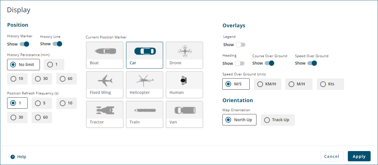
Position
History Marker
When the Show button is enabled  )
)
When the Show button is disabled  )
)
History Line
When the Show button is enabled )
When the Show button is disabled )
History Persistence
Select an option to choose how long, in minutes, the History Markers and History Line are shown on the Position Overview map.
Position Refresh Frequency
Select an option to choose how often, in seconds, the current position of the vehicle is updated on the Position Overview map.
Current Position Marker
Select an option to choose the icon used to represent the vehicle on the Position Overview map.
Overlays
The Overlay settings control the information that is shown on the Position Overview map.
Legend
When the Show button is enabled )
When the Show button is disabled )
Heading
When the Show button is enabled )
The receiver must have ALIGN configured before a heading value is shown on the map.
When the Show button is disabled )
Course Over Ground
When the Show button is enabled )
When the Show button is disabled )
Speed Over Ground
When the Show button is enabled )
When the Show button is disabled )
Speed Over Ground Units
Select the option for the units in which the speed over ground is displayed.
-
M/S – metres per second
-
KM/H – kilometres per hour
-
M/H – miles per hour
-
Kts – knots (nautical miles per hour)
Orientation
The Orientation settings control the orientation of the Position Overview map.
Map Orientation
When North Up is selected, the Position Overview map is oriented so north points up. The map orientation does not change based on vehicle track.
When Track Up is selected, the orientation of the Position Overview map changes so the direction of vehicle travel (track) points up. The compass symbol on the Position Overview map adjusts so the red arrow points north.