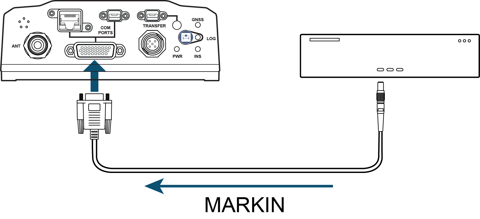
MARKPOS, MARK2POS, MARK3POS and MARK4POS
Position at time of mark input event
|
Platform: |
OEM719, OEM729, OEM7500, OEM7600, OEM7700, OEM7720, PwrPak7, CPT7, CPT7700, SMART2 |
This log contains the estimated position of the antenna when a pulse is detected at a mark input.
-
MARKPOS is generated when a pulse occurs on the MK1I (EVENT_IN1) input.
-
MARK2POS is generated when a pulse occurs on the MK2I (EVENT_IN2) input.
-
MARK3POS is generated when a pulse occurs on the MK3I (EVENT_IN3) input (OEM7600, OEM7700, OEM7720, PwrPak7, CPT7 and CPT7700 only).
-
MARK4POS is generated when a pulse occurs on the MK4I (EVENT_IN4) input (OEM7600, OEM7700 and OEM7720 only).
The position at the mark input pulse is extrapolated using the last valid position and velocities. The latched time of mark impulse is in GPS reference weeks and seconds into the week. The resolution of the latched time is 10 ns. See also the notes on MARKPOS in the MARK1TIME, MARK2TIME, MARK3TIME and MARK4TIME log.
The position for the MARKPOS, MARK2POS, MARK3POS and MARK4POS logs are reported in the user selected datum. See the DATUM command for more details.
|
Message ID: |
181 (MARKPOS) |
Log type: Asynch
Recommended input:
log markposa onnew
|
|
|
Abbreviated ASCII example:
<MARKPOS COM1 0 89.0 FINESTEERING 1670 413138.000 02000020 c223 42770 SOL_COMPUTED SINGLE 51.11289233689 -114.02932170726 1018.9653 1049.4915 BUKIT 1.9372 1.1981 4.0909 "" 0.000 0.000 19 18 18 18 0 06 0 33
|
|

|
|
Field |
Field type |
Description |
Format |
Binary bytes |
Binary offset |
|
1 |
Log header |
MARKPOS / MARK2POS / MARK3POS / MARK4POS header For information about log headers, see ASCII, Abbreviated ASCII or Binary. |
|
H |
0 |
|
2 |
sol status |
Solution status (see Table: Solution status) |
Enum |
4 |
H |
|
3 |
pos type |
Position type (see Table: Position or velocity type) |
Enum |
4 |
H+4 |
|
4 |
lat |
Latitude (degrees) |
Double |
8 |
H+8 |
|
5 |
lon |
Longitude (degrees) |
Double |
8 |
H+16 |
|
6 |
hgt |
Height above mean sea level (m) |
Double |
8 |
H+24 |
|
7 |
undulation |
Undulation - the relationship between the geoid and the WGS84 ellipsoid (m) When using a datum other than WGS84, the undulation value also includes the vertical shift due to differences between the datum in use and WGS84. |
Float |
4 |
H+32 |
|
8 |
datum id# |
Datum ID number 61 = WGS84 63 = USER |
Enum |
4 |
H+36 |
|
9 |
lat σ |
Latitude standard deviation (m) |
Float |
4 |
H+40 |
|
10 |
lon σ |
Longitude standard deviation (m) |
Float |
4 |
H+44 |
|
11 |
hgt σ |
Height standard deviation (m) |
Float |
4 |
H+48 |
|
12 |
stn id |
Base station ID |
Char[4] |
4 |
H+52 |
|
13 |
diff_age |
Differential age in seconds |
Float |
4 |
H+56 |
|
14 |
sol_age |
Solution age in seconds |
Float |
4 |
H+60 |
|
15 |
#SVs |
Number of satellites tracked |
Uchar |
1 |
H+64 |
|
16 |
#solnSVs |
Number of satellites used in solution |
Uchar |
1 |
H+65 |
|
17 |
#ggL1 |
Number of satellites with L1/E1/B1 signals used in solution |
Uchar |
1 |
H+66 |
|
18 |
#solnMultiSVs |
Number of satellites with multi-frequency signals used in solution |
Uchar |
1 |
H+67 |
|
19 |
Reserved |
Uchar |
1 |
H+68 |
|
|
20 |
ext sol stat |
Extended solution status (see Table: Extended solution status) |
Hex |
1 |
H+69 |
|
21 |
Galileo and BeiDou sig mask |
Galileo and BeiDou signals used mask (see Table: Galileo and BeiDou signal-used mask) |
Hex |
1 |
H+70 |
|
22 |
GPS and GLONASS sig mask |
GPS and GLONASS signals used mask (see Table: GPS and GLONASS signal-used mask) |
Hex |
1 |
H+71 |
|
23 |
xxxx |
32-bit CRC (ASCII and Binary only) |
Hex |
4 |
H+72 |
|
24 |
[CR][LF] |
Sentence terminator (ASCII only) |
- |
- |
- |