UNDULATION
Chooses undulation
|
Platform: |
OEM719, OEM729, OEM7500, OEM7600, OEM7700, OEM7720, PwrPak7, CPT7, CPT7700, SMART7, SMART2 |
This command permits you to enter a specific geoidal undulation value. In the option field, the EGM96 table provides ellipsoid heights at a 0.5° by 0.5° spacing while the OSU89B is implemented at a 2° by 3° spacing. In areas of rapidly changing elevation, you could be operating somewhere within the 2° by 3° grid with an erroneous height. EGM96 provides a more accurate model of the ellipsoid which results in a denser grid of heights. It is also more accurate because the accuracy of the grid points themselves has also improved from OSU89B to EGM96. For example, the default grid (EGM96) is useful where there are underwater canyons, steep drop-offs or mountains.
The undulation values reported in the position logs are in reference to the ellipsoid of the chosen datum.
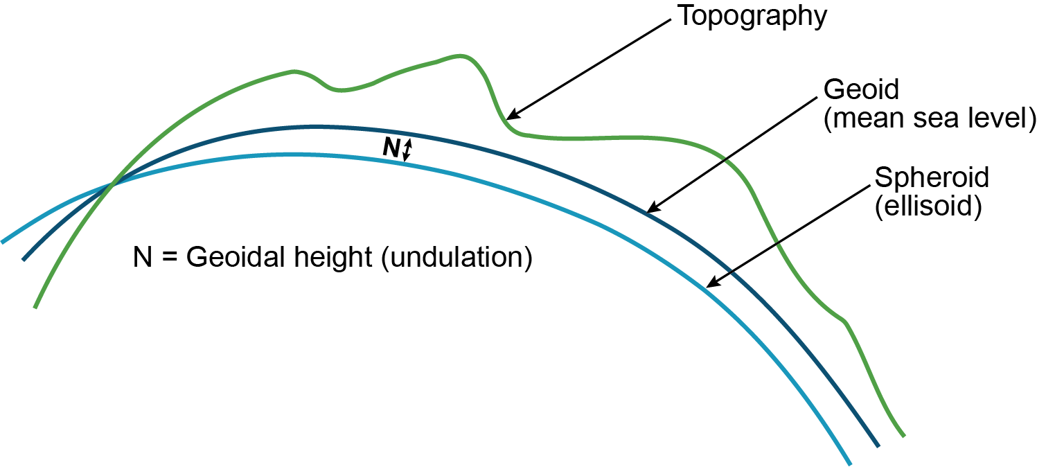
Refer to the application note APN-006: Geoid Issue, available at novatel.com/support/support-materials/application-notes, for a description of the relationships in Figure: Illustration of undulation.
Message ID: 214
Abbreviated ASCII syntax:
UNDULATION option [separation]
Factory default:
UNDULATION egm96 0.0000
ASCII example 1:
UNDULATION osu89b
ASCII example 2:
UNDULATION USER -5.599999905
|
Field |
Field type |
ASCII value |
Binary value |
Description |
Format |
Binary bytes |
Binary offset |
|---|---|---|---|---|---|---|---|
|
1 |
Command header |
- |
- |
UNDULATION header This field contains the command name for abbreviated ASCII or the message header for ASCII or Binary. |
- |
H |
0 |
|
2 |
option |
USER |
1 |
Use the user specified undulation value |
Enum |
4 |
H |
|
OSU89B |
2 |
Use the OSU89B undulation table |
|||||
|
EGM96 |
3 |
Use global geoidal height model EGM96 table |
|||||
|
3 |
separation |
±1000.0 m |
The undulation value (required for the USER option) (default = 0.000) |
Float |
4 |
H+4 |
|